Industry Solutions
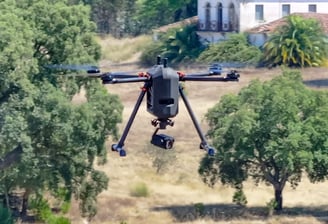
Eagle AI Drones enhances operational efficiency across the industry sectors of military & defence, civil authority, energy & infrastructure, agriculture, private security and logistics.

Military & Defence
NATO certified, our UAVs have become a cornerstone of modern military and defence operations, providing unparalleled capabilities in surveillance, reconnaissance, and tactical support.
Our UAVs enhance situational awareness by delivering real-time intelligence, surveillance, and reconnaissance (ISR) data, enabling informed decision-making on the battlefield, on land or sea.
They also reduce risks to personnel by performing high-risk missions such as target acquisition, border patrol, and search-rescue operations.
Their ability to operate in hostile environments and provide persistent monitoring makes them indispensable in modern warfare.
Key solutions:
Intelligence, Surveillance, and Reconnaissance (ISR): Gather real-time data on enemy movements, terrain, and threats
Target Acquisition: Identify and track high-value targets with precision
Border Security: Monitor and patrol national borders on land and at sea, for unauthorised crossings or smuggling activities
Combat Support: Provide aerial support for ground troops, including overwatch and communication relay
Search and Rescue: Locate and assist downed pilots or stranded personnel in hostile environments.
Electronic Warfare: Disrupt enemy communications and radar systems
Force Protection: Monitor and secure military bases, convoys, and critical infrastructure
Training and Simulation: Provide realistic training scenarios for military personnel using drone technology
Persistent Monitoring: Conduct long-endurance missions for continuous surveillance of areas of interest.
Logistics Support: Deliver supplies, ammunition, and equipment to remote or frontline troops
Our drones and system effective for this specific sector are:
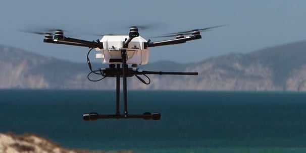
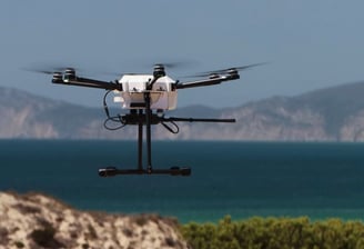
VTOne
HEIFU Pro
BVQ418
beXStream (Drone/Asset management platform)
Civil Authorities
Our UAVs, are increasingly being adopted by civil authorities to enhance public safety, improve operational efficiency, and respond effectively to emergencies.
Equipped with advanced sensors, cameras, and real-time data transmission capabilities, our UAVs provide civil authorities with critical tools for surveillance, disaster management, and infrastructure monitoring.
They enable rapid response to incidents, reduce risks to personnel, and offer cost-effective solutions for a wide range of applications.
From law enforcement to firefighting and disaster relief, our UAVs are invaluable assets in ensuring the safety and well-being of communities.
Key solutions:
Law Enforcement: Monitor large public events, track suspects, and conduct search operations in urban or remote areas
Disaster Response: Assess damage, locate survivors, and deliver emergency supplies in disaster-affected areas
Search and Rescue: Locate missing persons or stranded individuals using thermal imaging and high-resolution cameras
Traffic Monitoring: Manage traffic flow, detect accidents, and support accident investigations
Firefighting: Provide real-time aerial views of wildfires, assess fire spread, and identify hotspots using thermal imaging
Infrastructure Inspections: Monitor bridges, roads, and public utilities for damage or wear without disrupting daily activities
Environmental Monitoring: Track pollution, monitor wildlife, and assess environmental changes
Crowd Control: Oversee large gatherings or protests to ensure public safety and prevent incidents
Emergency Communications: Establish temporary communication networks in areas with damaged infrastructure
Flood and Storm Assessment: Survey flood-affected areas and plan relief efforts using aerial data
Public Health Support: Deliver medical supplies or conduct aerial spraying for disease control in hard-to-reach areas
Wildlife and Fishery Tracking: Monitor wildlife populations, track migratory patterns, and enforce anti-poaching laws. Our UAVs can also assess fish stocks and monitor illegal fishing activities in marine or freshwater environments
Cost Efficiency: Reduce the need for expensive manned aircraft or ground personnel for routine monitoring tasks
Our drones and system effective for this specific sector are:
VTOne
HEIFU Pro
BVQ418
beXStream (Drone/Asset management platform)
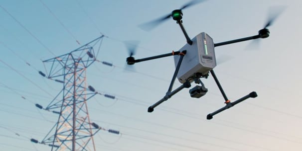
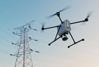
Energy & Infrastructure
Our UAVs are playing a pivotal role in the energy, renewable energy, and infrastructure sectors by enhancing safety, efficiency, and cost-effectiveness, as well as driving innovation and sustainability.
Our UAVs provide advanced inspection, monitoring, and maintenance solutions for energy and renewable energy infrastructures such as power lines, wind turbines (towers & blades), solar farms, and pipelines, reducing the need for risky manual inspections.
For infrastructure projects, UAVs enable detailed surveying, progress tracking, and structural inspections, ensuring timely and accurate project delivery.
By leveraging UAV technology, these sectors can improve operational efficiency, reduce downtime, and enhance safety.
Key solutions:
Energy Sector
Power Line Inspections: Conduct aerial inspections of transmission lines and towers to identify faults or damage
Pipeline Monitoring: Survey oil and gas pipelines for leaks, corrosion, or encroachments
Thermal Imaging: Detect overheating components in electrical infrastructure to prevent failures
Substation Inspections: Perform safe and efficient inspections of high-voltage substations
Emergency Response: Assess damage and plan repairs during power outages or disasters
Renewable Energy Sector
Wind Turbine Inspections: Inspect turbine blades and structures for wear, cracks, or damage without requiring scaffolding or climbing
Solar Farm Monitoring: Use thermal imaging to identify faulty or underperforming solar panels
Site Assessment: Survey potential locations for wind or solar farms to evaluate terrain and environmental factors
Performance Analysis: Monitor energy output and efficiency of renewable energy installations
Maintenance Planning: Schedule and prioritise maintenance tasks based on drone-collected data
Infrastructure Sector
Construction Site Monitoring: Track progress, manage resources, and ensure compliance with plans using aerial surveys
Bridge and Road Inspections: Assess the condition of infrastructure without disrupting traffic or requiring costly equipment
3D Mapping: Create detailed topographic maps and models for planning and design purposes
Structural Inspections: Evaluate the integrity of buildings, dams, and other structures using high-resolution imaging
Disaster Assessment: Quickly assess damage to infrastructure after natural disasters or accidents
Our drones and system effective for this specific sector are:
HEIFU Pro
BVQ418
beXStream (Drone/Asset management platform)
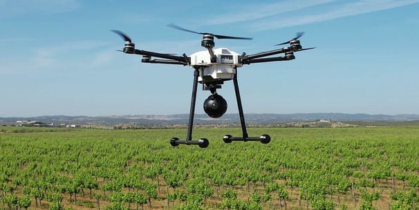
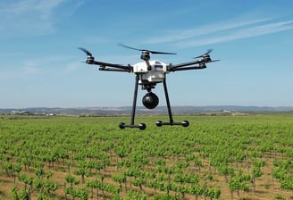
Agriculture
Our UAVs are transforming the agriculture sector by providing farmers with advanced tools to enhance productivity, optimise resource use, and improve crop management.
Equipped with sensors, cameras, and GPS technology, our UAVs enable precision agriculture by collecting detailed data on crop health, soil conditions, and field variability.
This data-driven approach allows farmers to make informed decisions, reduce waste, and increase yields.
UAVs also reduce labour costs and time by automating tasks such as crop monitoring, spraying, and planting, making them an indispensable asset for modern farming.
Key solutions:
Crop Monitoring: Capture high-resolution images and multispectral data to assess crop health and growth
Automated Precision Spraying: Automation of the application of fertilizers, pesticides, and herbicides accurately to reduce chemical use and costs
Soil Analysis: Map soil conditions, moisture levels, and nutrient content for better land management
Planting: Automate seed planting in precise patterns to optimise crop density and growth
Irrigation Management: Identify areas with water stress and optimise irrigation systems
Pest and Disease Detection: Detect early signs of infestations or diseases using thermal and multispectral imaging
Yield Estimation: Predict crop yields by analyzing field data and growth patterns
Livestock Monitoring: Track and manage livestock movements and health using aerial surveillance
Field Mapping: Create detailed 3D maps of fields for better planning and resource allocation.
Time and Labour Savings: Automate repetitive tasks, reducing the need for manual labor and saving time
Our drone and system effective for this specific sector are:
HEIFU Pro
beXStream (Drone/Asset management platform)
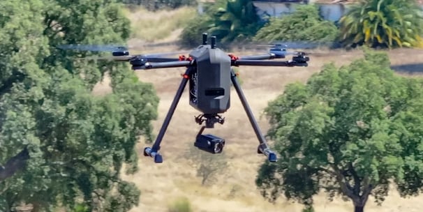
Private Security
Our UAVs have become a transformative tool in the private security sector, offering enhanced surveillance, rapid response, and cost-effective monitoring solutions.
Equipped with high-resolution cameras, thermal imaging, and real-time data transmission, UAVs provide security teams with unparalleled situational awareness, enabling them to monitor large areas, track suspicious activities, and respond to incidents more efficiently.
Their ability to access hard-to-reach or hazardous locations further enhances their utility in safeguarding assets and personnel.
Key solutions:
Thermal Imaging: Detect heat signatures for night-time or low-visibility operations
Perimeter Patrols: Conduct automated or manual patrols to secure boundaries
Crowd Monitoring: Manage and oversee large gatherings or events for safety and security
Evidence Collection: Capture high-quality footage for investigations or legal purposes
Cost Efficiency: Reduce the need for extensive ground personnel and physical infrastructure
Disaster Assessment: Evaluate damage or risks in emergency situations without endangering personnel
Access to Hazardous Areas: Inspect dangerous or hard-to-reach locations safely
Our drones and system effective for this specific sector are:
HEIFU Pro
BVQ418
beXStream (Drone/Asset management platform)
Logistics
Our UAVs are revolutionising the logistics sector by streamlining operations, reducing costs, and improving efficiency, thus positioning such companies at the forefront of innovation in the industry.
The UAVs enable faster delivery of goods, especially in hard-to-reach or congested areas, while minimizing human intervention and operational downtime.
They also enhance inventory management, warehouse operations, and transportation monitoring through real-time data collection and analysis.
By automating repetitive tasks and providing actionable insights, UAVs are helping logistics companies optimise their supply chains and meet the growing demands of modern commerce.
Key solutions:
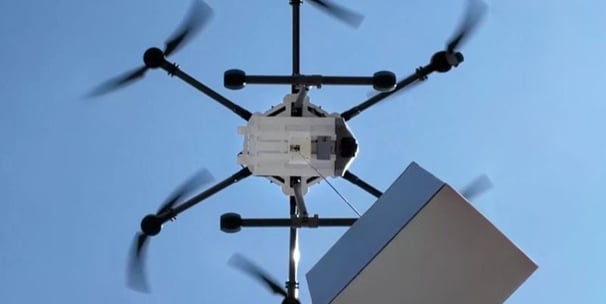
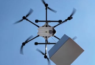
Last-Mile Delivery: Deliver packages quickly and efficiently, especially in urban or remote areas
Inventory Management: Conduct automated stock checks and monitor warehouse inventory using drones
Route Optimisation: Assess traffic and road conditions to plan the most efficient delivery routes
Real-Time Tracking: Monitor shipments and vehicles in transit for enhanced visibility
Warehouse Operations: Use drones for aerial inspections, storage organisation, and asset tracking
Reduced Delivery Times: Speed up the delivery process, particularly for time-sensitive goods
Cost Savings: Lower fuel and labor costs associated with traditional delivery methods
Access to Remote Areas: Deliver supplies to rural or disaster-affected regions with limited infrastructure
Condition Monitoring: Inspect cargo for damage or tampering during transit
Sustainability: Reduce carbon emissions by replacing traditional delivery vehicles with drones
Our drones and system effective for this specific sector are:
HEIFU Pro
BVQ418
beXStream (Drone/Asset management platform)
Contact Us
Get in touch with Eagle AI Drones for inquiries about our advanced UAV solutions.